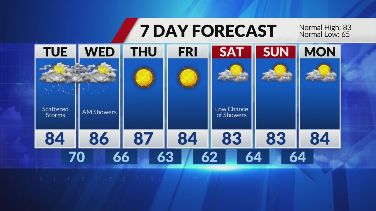

ST. LOUIS – A slightly active pattern remains locked-in for the next 24 hours. First, we will watch for a decaying storm complex south of us to surge north, bringing scattered activity this morning for southeastern Missouri into southern Illinois.
This may or may not have a limit on afternoon or evening activity. More scattered storms will bubble up this afternoon if the atmosphere recovers from this morning’s storm complex, with the heat of the day, much like how yesterday unfolded.
If these storms strengthen to severe limits, it will be a low risk with 60 MPH winds and quarter-sized hail. This continues through sundown, before the arrival of another front on the move from the northwest.
This will be the kick these storms need to fire up overnight into early Wednesday morning. Again, a low threat for severe weather. Storm energy shifts east by lunchtime Wednesday as high pressure takes its place.
We remain dry and quiet for the end of the workweek, with highs in the 80s and wake-up temps in the low 60s. A small chance for showers and storms returns this weekend.
Comments are closed.