
ST. LOUIS – Clouds have increased across much of the region and will continue to do so. While most of the region will stay dry for most of the day, a few showers could hit our northern counties.
Clouds and some sun Friday afternoon, with highs near 90 but with increasing humidity, heat index values will feel hotter. Overnight showers and storms will roll toward the region, making it to our area.
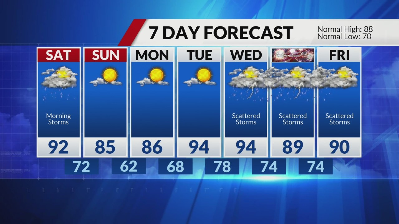
Storms should continue to weaken, hopefully below severe limits, but a few storms could potentially be strong, with strong wind gusts being the main concern along with locally heavy rainfall. Showers and any leftover storms should exit most of the region by mid-morning.
Saturday will be hot and very humid ahead of a cold front. Highs in the mid-90s with heat index values around 100.
There is at least a slight chance for a few additional storms Saturday afternoon and evening as the cold front makes its way into the area.
The cold front will bring relief on Sunday. Temperatures and humidity both drop off, with highs only in the low to mid 80s.
Comments are closed.