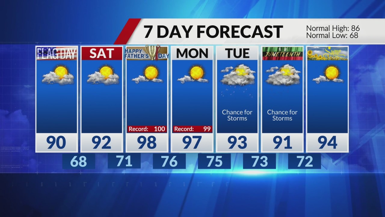

ST.LOUIS– We made it to 91 on Wednesday, beginning our stretch of hot weather. Hotter and more humid Thursday, highs in the mid 90s. That will send the heat index value close to 100.
A cold front will drop into Missouri and Illinois Thursday evening and some strong to severe storms are expected just ahead of it. The strongest storms are expected to be north of the St. Louis region, especially north of Moberly, Mo., to Hannibal to Rushville, Ill.
The storms look to lose some punch as they move farther south. However, let’s watch for some showers and storms to hold together as far south as the I-70 corridor into the night timeframe.
The passing cold front will knock temperatures back a touch on Friday before the heat and humidity build again over the weekend. Sunday, Father’s Day, and Monday look to be the hottest days, with afternoon top temperatures pushing into the upper 90s and heat index values at or above 100.
We are watching for some rain chances starting Tuesday that might help bring temperatures back down a bit.
Comments are closed.