
ST. LOUIS – After two quiet, comfortable days, action begins to pick back up for the St. Louis region. First, it will be hotter Tuesday, with highs in the low to mid 90s and lots of sunshine. It will be a bit muggier as well, but not extremely humid.
Starting tonight, there will be several rounds of storms on the way as we head towards the Independence Day holiday. A cold front brings an initial round of storms Tuesday night.
These storms are expected to be strong to severe over northwest Missouri but weaken in intensity as they drop southeast towards St. Louis.
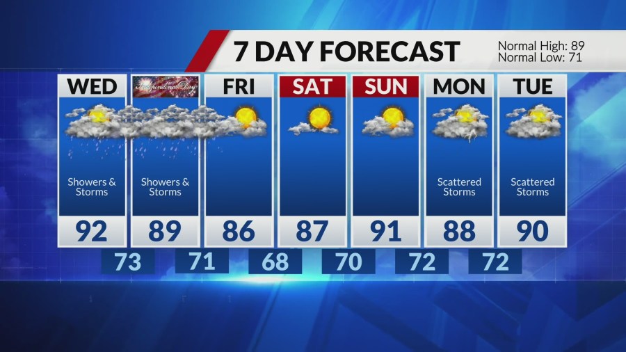
That cold front continues to sink south on Wednesday, bringing additional storm threats through the afternoon. Signs are pointing to the best location for stronger storms to be just southeast of metro St. Louis, but we’ll watch things closely. Highs Wednesday again in the low 90s.
As for Independence Day, it looks unsettled. Storms are expected early and again late in the day. Highs near 90. Be ready to adjust plans for the day. We will dry out into the weekend.
Comments are closed.